Saturday, July 20, 2013

Fast stepping the Rest of Mainland Puerto Rico


After returning from Houston, Texas to celebrate Grandson Bryson's 6th birthday and Dad Moore's 90th birthday, it was time to get serious about heading south for hurricane season.  As the official hurricane season begins June 1st, the rest of our trip through Puerto Rico was a scurry of "one nighters" to get to the US Virgin Islands.  We skirted the rest of the coast of the mainland and headed for Vieques.

 
Salinas, Puerto Rico (May 25-26 , 2013)

Originally, we intended to stay a few days in Salinas; however, arriving in late May, we found the harbor very crowded as Salinas is a recommended hurricane hole and many were already anchored to wait out the hurricane season. This combined with the fact we kept dragging anchor inspired us to leave the next afternoon and continue our trek to the east end of the island.


Bahia de Jobos, Puerto Rico (May 26-27, 2013)

We would have loved to have spent more time here.  As the sun set, we tucked Dulcinea back in the mangroves and spent the night all alone.  It was as if the world was our own, not another boat to be found. The next morning, we pulled anchor and were off to Puerto Patillas.


Puerto Patillas, Puerto Rico (May 27-30, 2013)


As we had no internet here and only planned to stay overnight, we spent a pleasant day catching up on reading, doing a few boat chores and just relaxing.  With such a short stay, we decided to leave the dinghy on the davits so we never got off the boat to go scouting, but instead just enjoyed all the beauty we could see from the bay.  It was great!  A manatee even stopped by to entertain us during happy hour.

Puerto Patillas - A great view from the bow of s/v Dulcinea

Yet another great view off our port side

Off our starboard side was what appeared to be a nice resort


As it is in most of Puerto Rico, the Flamboyant trees are gorgeous
 
We found Puerto Patillas to be a delightful stop.  Even so, we had planned to only be there overnight; however, we would visit her twice as rough seas forced us to return and try again.

Upon departing Puerto Patillas, we made it as far as Punta Tuna when all hell broke loose so we decided it best to return to wait for better weather conditions.  Although the second trip out was not much better, we were determined to trudge through it.  Even on a good day, the seas are rough along the coast of Punta Tuna.  For us, neither day was a good day for sailing, so we were ecstatic to get Palmas del Mar in our sights.


Palmas del Mar, Puerto Rico (May 31-June 2, 2013)


Having been beat up by the weather once again, we decided to head into the Palmas del Mar Yacht Club.  The worst I can say about Palmas del Mar is that it is a rolly harbor.  Otherwise, this is a BEAUTIFUL place to be.  The staff at the yacht club are phenomenal and the surrounding areas are stunningly beautiful. So beautiful, we decided to stay a few extra days.

Dulcinea in her slip

The view from our stern - This mansion was most beautiful when lit up at night


Two places we visited were outstanding enough to mention: Chihuahua Tex Mex Cantina and Yogen Früz.

We found the local food in Puerto Rico to be so bland we thought we were in Britain; however, the Chihuahua Tex Mex Cantina gave our tastebuds a whirl with a spicy jalapeno sauce atop chicken nachos.  It was fabulous!  To cool our tongues, we headed across the plaza to treat ourselves to a frozen yogurt with fresh fruit at the local Yogen Früz.  Definitely a lunch to gloat about.

The Chihuahua Tex Mex Cantina


Yogen Früz

No longer hungry, we set off to see as much of the area as possible.

A view of the northern Caribbean Sea


Another Flamboyant Tree


Plaza Del Mar Resort


Time to head to the beach

Sea Turtle Nesting Area?  We didn't see any turtles.

Jim beats feet to the beach...

and wishes he had brought his surfboard along


Palmas del Mar Yacht Club


We love it here!


This was even less comfortable than it looks


You know those pictures you don't post for fear of retaliation, one of those goes right here.  Sorry, I'm not willing to take the chance by posting it, but I can laugh about it. [Jim gives me the evil eye]


A Real Caribbean Sailor


Jim is somewhere in all of those trees


A nice place to sit


Tree Hugger


(This is where Jim would insert his "payback" photo)


This beach was so incredibly beautiful and we had it all to ourselves

Surf's up, but watch out for the rocks

Coastline behind the yacht club

Ponce, Puerto Rico (Part 5) - El Yunque Rainforest

Ponce, Puerto Rico (May 3 -25 , 2013)


El Yunque Rainforest
: 


Entering the special world of the El Yunque Rainforest, you may find the legend of the "raining frogs" to be true.  One can catch a shower of the tiny and musical coquí tree frog. Their natural predators, knowing the frogs climb to the great heights of the forest canopy, lie in wait for them. In their panic to escape to safety, the coquís will leap into the air and actually float down to the ground. "Raining frogs" indeed!


The forest was teaming with beauty everywhere!

The giant fern or stick shrimp (Cyathea arborea)
A
n evergreen fan-shaped fern that can reach 29 feet in height

The beautiful bark of the Eucalyptus tree

The humid environment is ideal for the development
of moss on trees and rocks

Hibiscus

La Coca Falls is named for its 14th century owner, Spanish settler Juan Diego de La Coca. Puerto Rico properties are typically referred to by shortened versions of the owner's name. Located 450 feet above sea, La Coca Falls rises up another 85 feet before reaching the top of the falls.
La Cascada La Coca


Here we are at La Coca Falls


Jim gets a closer look at the Falls

The Tainos believed that Yukiyú, also known as the god of peace and tranquility, was the protector of the people during hurricanes.  He represented goodness.  His brother Juracán, the hurricane god, was believed to be evil and was responsible for storms.

Heading to Yokahu Tower


Observation deck atop Yokahu Tower
Overlooking Sierra de Luquillo


The Luquillo Mountains provide much of the water to the eastern portion of the San Jaun, including Fajardo, Cieba as well as Luquillo.

Heading down a path into the rainforest

Signs were clearly posted along the paths to avoid the local Small Indian Mongoose.
Rabies???  We don't want to meet this little guy!!!

But we did!!!

The Mongoose was most interested in our picnic lunch
He liked our PBJ almost as much as we did


Bird watching

La Mina Falls

More La Mina Falls

Who is behind that wall of water?

It's Jim relaxing at the bottom of La Mina Falls
Only a 3,055 foot wall of water above him


No doubt, this was the place to be

Another awesome path

Interesting stone numbers along the path

Yellow-Chinned Anole

No troubled waters under this bridge

U.S. sponsored projects are everywhere in Puerto Rico


Somehow, I don't think Jim liked my driving


Could it have been the switchback curves...


or the 1,500 foot drop off on his side of the car?


After more than 2 hours of switchback curves up and down mountain ranges, we finally made it out of the mountains and back to the Ponce Yacht Club, safe and sound.


Ponce, Puerto Rico (Part 4) - Arecibo Observatory

Ponce, Puerto Rico (May 3 -25 , 2013)


Arecibo Observatory: 

Arecibo Radiotelescope
The largest radiotelescope in the world, the Arecibo Radiotelescope, sits in a karst sinkhole that measures 1,300 feet across.  The dish alone covers 20 acres and is used to explore the heavens.

The observatory is located deep in a very rural area of Arecibo. If the drive wasn't challenging enough with it's continuous hairpin turns on a straight up incline, you are met with a 10 minute hike from the parking lot up a straight incline of stairs to reach the ticket office and museum.

The price per ticket is $16.  That did not fit in our cruising budget, but we didn't want to miss this. With Jim's background in engineering, we found it to be well worth the drive and the admission price.  This marvel was a must see for us.


Grote Reber, the first Radio Astronomer, invented the radio telescope.  Early on, he pursued it as a hobby and built a 31-foot parabolic antenna and made the first radio maps of the sky in 1937.

Grote Reber, The First Radio Astronomer


A special "Reflector Shoe" is required to walk on the reflector panels to protect the panels by distributing a person's weight.
Comprised of 38,778 aluminum panels, this is the largest reflector on earth.
The reflector weighs 300 tons.


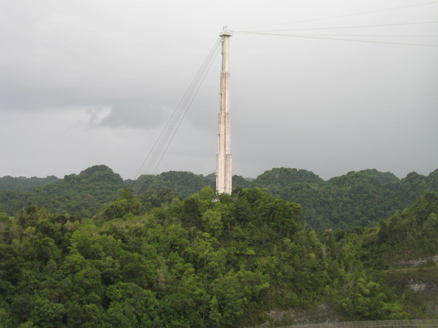
The receiver is suspended by cables running between three reinforced concrete towers with their tops placed at the same elevation.
Concrete tower at a distance

Close up of Platforms, Receiver, Gregorian Dome, Line Feed,
and part of the Azimuth Arm


Taking it all in


39 steel cables are needed to support the 1,000 ton platform.  The combined cable length is 4 miles. Each cable strung between the tower and the platform weighs 10 tons.

One of three concrete towers and anchor cables


Norma is a constellation located in the southern hemisphere between Scorpius and Centaurus. Norma is the Latin word for "normal" and represents a carpenter's square, used in the Age of Exploration by carpenters on exploratory vessels.
Look Mom, you have your own constellation


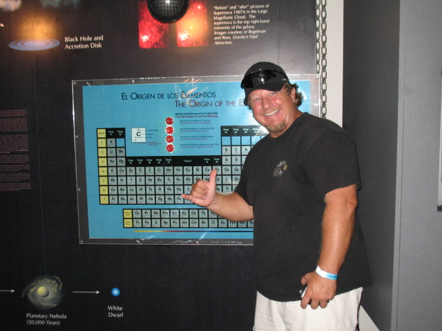
The Periodic Table
Jim in his "element"